
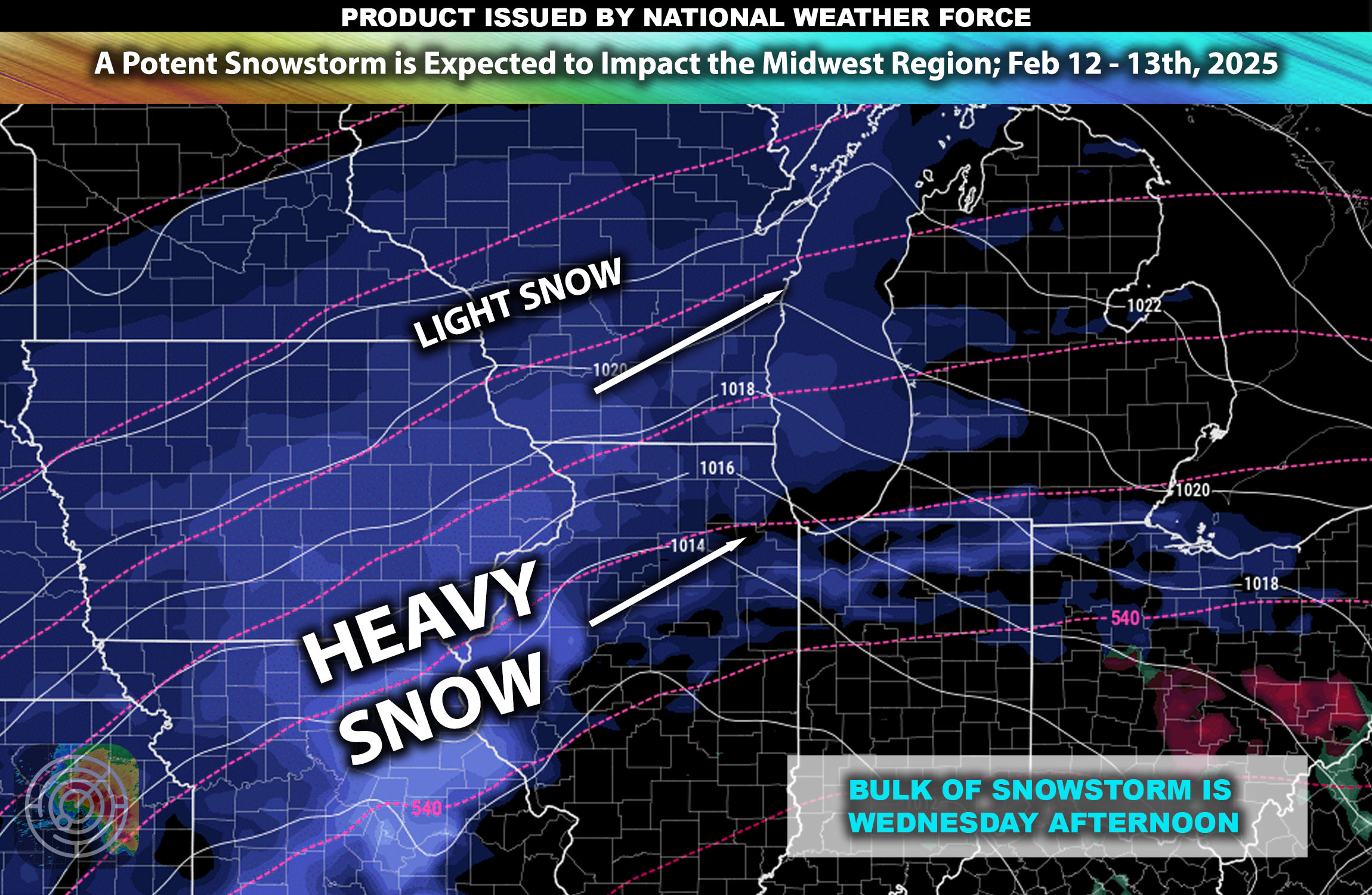
Overall Forecast: The Midwest is bracing for a decent snowstorm expected to affect the region from Wednesday through early Thursday. This event is forecasted to bring widespread snowfall, with some areas also experiencing mixed precipitation, particularly along the southern edges of the storm system where more warm air is mixed.
Upper-Level Forecast:
A potent low-pressure system is set to move across the Midwest, driven by a strong upper-level jet stream. This system will interact with cold Arctic air, leading to the development of heavy snowfall across much of the region. The presence of moist air feeding into the system will enhance snowfall rates during the peak of the storm.
Snow Forecast:
- Midwest Region: Heavy snow is anticipated across the entire Midwest, with snowfall totals expected to range from 4 to 8 inches in most areas locally higher. Certain northern parts may see even higher accumulations exceeding 12 inches, especially in areas where the snow bands persist the longest.
Other Impact Details:
- Mixed Precipitation: Areas on the southern fringe of the storm may experience periods of sleet and freezing rain, adding to the travel hazards.
- Wind Forecast: Accompanying the snow, strong winds with gusts of 20 to 30 mph are expected, which could create blowing snow conditions, reduce visibility, and further complicate travel and road conditions.
Timing & Impact:
Snow showers are expected to start on Wednesday with the bulk of the heavier snow bands expected by Wednesday afternoon and evening hours. These bands will continue slowly becoming lighter as late Wednesday night approaches. Snow showers should start to taper off around Thursday early morning hours with mainly a few here and there.
Stay tuned for more updates.
-Sina