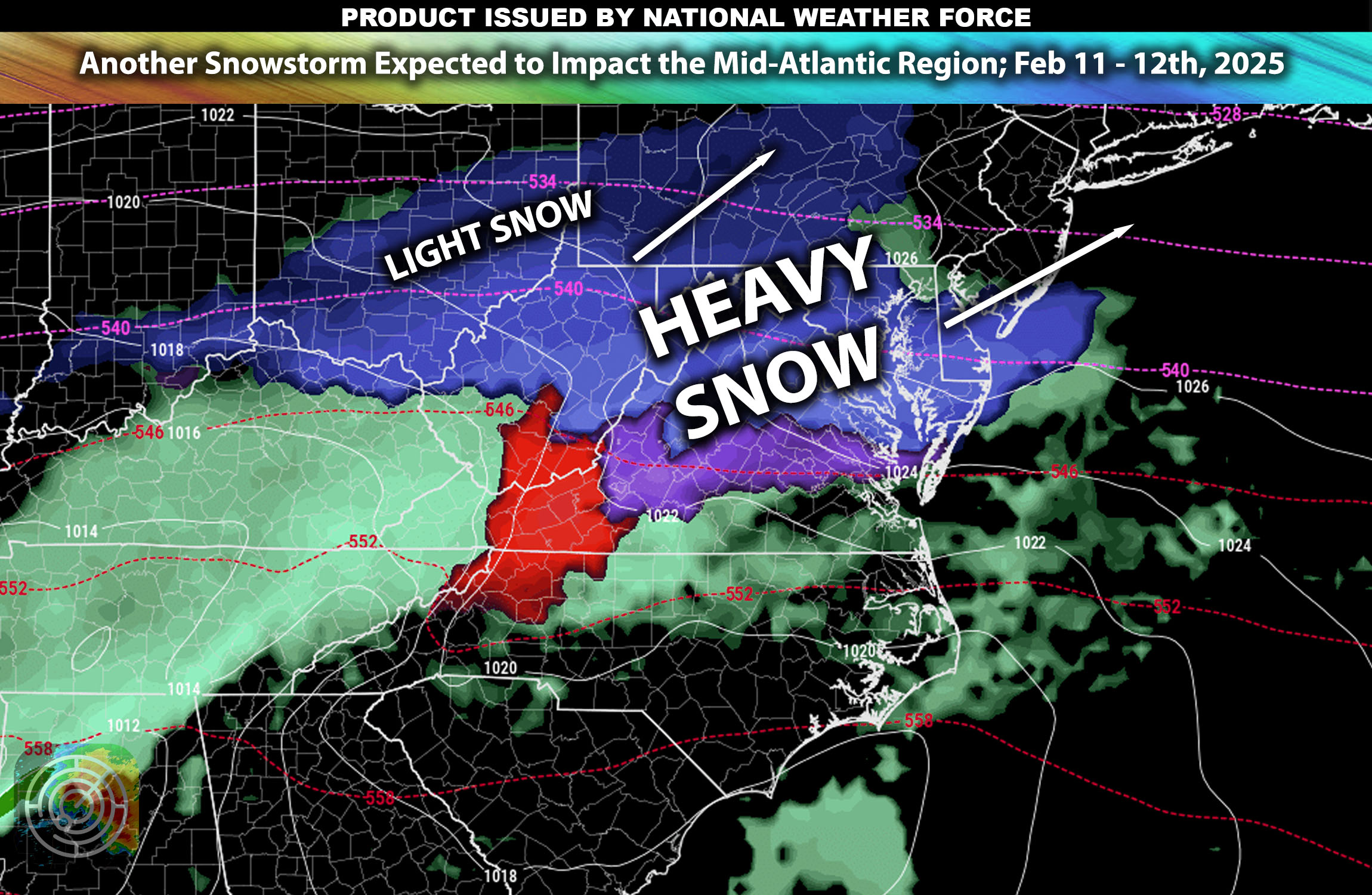
Overall Forecast: The Mid-Atlantic region is preparing for a significant snowstorm from Tuesday through early Wednesday. This event is expected to bring some heavy snowfall, accompanied by sharp drops in temperature and strong winds, affecting multiple areas from urban centers to rural locales.
Upper-Level Forecast:
A powerful upper-level trough will move across the Mid-Atlantic, enhancing cold air advection and atmospheric lifting capabilities. This setup will interact with a moist air mass moving northward from the Gulf, creating optimal conditions for heavy snowfall and sustained cold weather from south to north.
Snow Forecast:
- Mountainous Regions: Areas such as the Appalachian Mountains are expected to receive heavy snowfall, with accumulations potentially exceeding 8 inches in the highest elevations and locally much higher possible (depending on conditions).
- Urban and Suburban Areas: Major cities, including Washington D.C., Baltimore, and Philadelphia, could see snow accumulations of 3-6 inches locally higher.
Timing & Impact:
These snow squalls are currently ongoing in Richmond, VA, with more expected to reach the southern part of the Washington DC metro area around 2 PM ET, and by evening in Baltimore. Later in the evening, these snow showers will spread to parts of Pennsylvania, including Harford, before moving northward across the metro areas of New York and the rest of Pennsylvania. To the south of it will be sleet and mixed precipitation depending on where the warmer airmass will mix.
Stay tuned for more updates.
-Sina
