
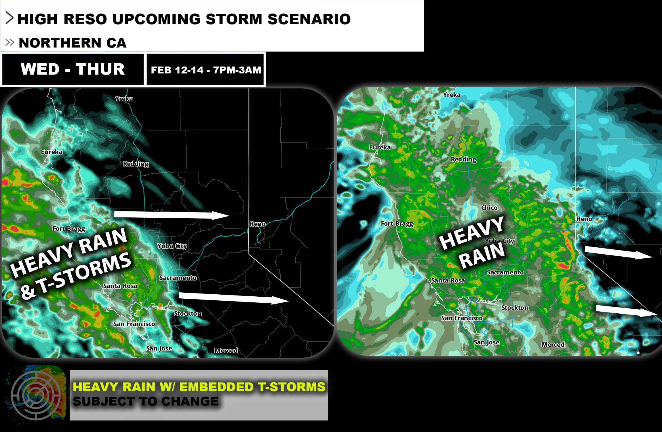
 Overall Forecast: Northern California is anticipating a powerful storm system, bringing significant weather impacts from Wednesday through Thursday. Individuals who are impacted should prepare for heavy rainfall and potential snow in higher elevations, which are expected to impact the region significantly.
Upper-Level Forecast: The storm is driven by a strong upper-level trough that will enhance vertical air movements and moisture influx, contributing to the formation of heavy precipitation across Northern California.
Rainfall Forecast:
- Northern California: The coastal and inland areas are bracing for substantial rainfall. The coastal regions could receive over 3 inches of rain, with potential for localized areas to exceed this amount significantly due to the intense nature of the storm. The inland regions are also expected to see heavy rainfall, which could lead to flooding and increased river levels. At the same time thunderstorms will also be likely especially embedded capable of producing all hazard types especially with the main line of storms and scattered storms that mature enough.
Snow Forecast:
- Northern California Mountains: Higher elevations are forecasted to receive significant snowfall during this period. Snow accumulation could be substantial in the mountainous regions, affecting travel and outdoor activities.
Wind Forecast:
- Coastal and Inland Areas: Accompanying the rain and snow, strong winds are expected with gusts that might exceed 45 mph, especially in exposed coastal and highland areas. These conditions could lead to downed trees and power outages.
Timing & Impact: The system will move into the area on Wednesday night and continue affecting the region through Thursday. The heaviest rainfall is expected on Wednesday, with ongoing effects such as flooding and strong winds lasting into Thursday. After Thursday evening storms will become more scattered and with time become isolated until Friday morning.
Stay tuned for more updates.
-Sina