
 Overall Forecast: The Southeast and Mississippi Valley are currently anticipating severe storms, with potential widespread impacts due to an incoming storm system. This system is expected to affect several areas with various severe weather events depending on the concentration of ingredients and timing.
Upper-Level Forecast: A potent upper-level jet stream is contributing to the weather instability across the region, enhancing the potential for severe weather development. This jet stream is aiding in creating an environment conducive to storm formation by providing significant upper atmospheric dynamics.
Detailed Forecast:
- Surface Conditions: The region is experiencing a mix of atmospheric conditions conducive to severe weather. Surface temperatures are warm enough to support thunderstorm activity, which is being enhanced by a cold front moving through the area. This front is likely contributing to the uplift required for thunderstorm development.
- Instability and Shear: There is noted instability across the area (not very high but enough) with sufficient moisture and rising air to support thunderstorm activity, including the potential for severe storms. The effective shear levels are conducive to the development of organized storm structures, including supercells, which could lead to tornadoes a few if right timing and ingredients align could be strong/long lived…
Timing & Impact:
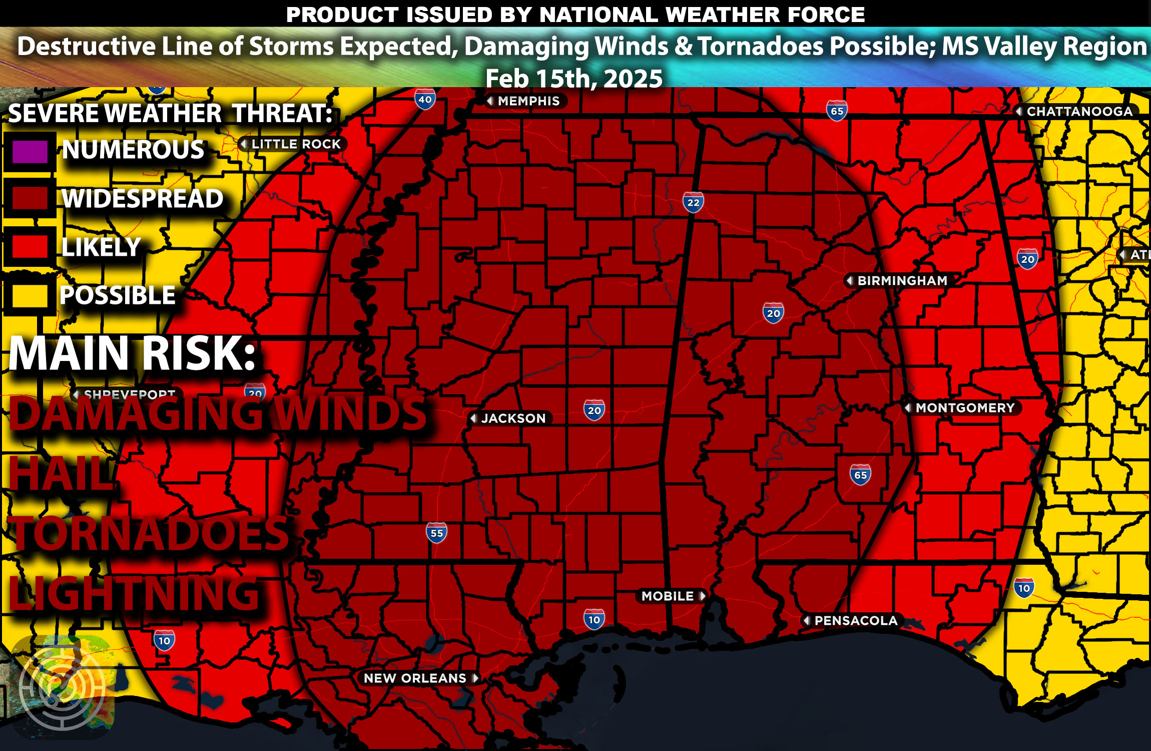
- The storm system is expected to impact the region throughout today, with the most intense activity being this evening and overnight. The primary concerns are damaging winds and the possibility of tornadoes, particularly in areas where the greatest instability coincides with strong shear across MS and neighboring states…This event is anticipated to be more linear with discreet cells embedded. However, a few isolated cells are also possible. The biggest risk with this event will be destructive straight-line winds given the ingredients present and the type of dynamics also present.
Main impact: tornadoes a few possibly strong, destructive winds, hail and lightning.
Stay tuned for more updates.
-Sina