
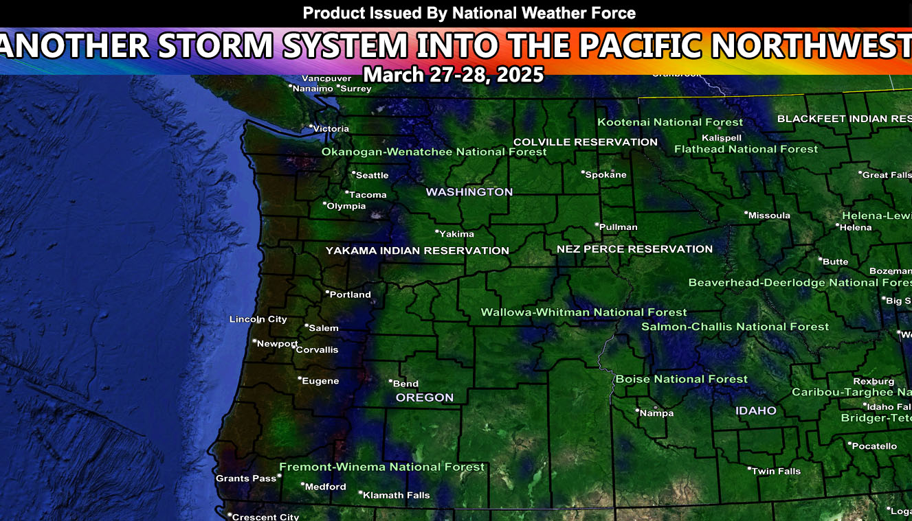
Another storm system is going to hit the Pacific Northwest today into tonight as the center of the surface low that brought yesterday’s severe weather activity moves into the region.
The thunderstorm zones will be Southeastern Washington, Northeast Oregon, and Western to Northern Idaho. The Panhandle of Idaho around Coeur d’Alene will have a chance of severe thunderstorms with this pattern this evening (March 27th). Isolated tornado, hail, and damaging winds likely in that zone.
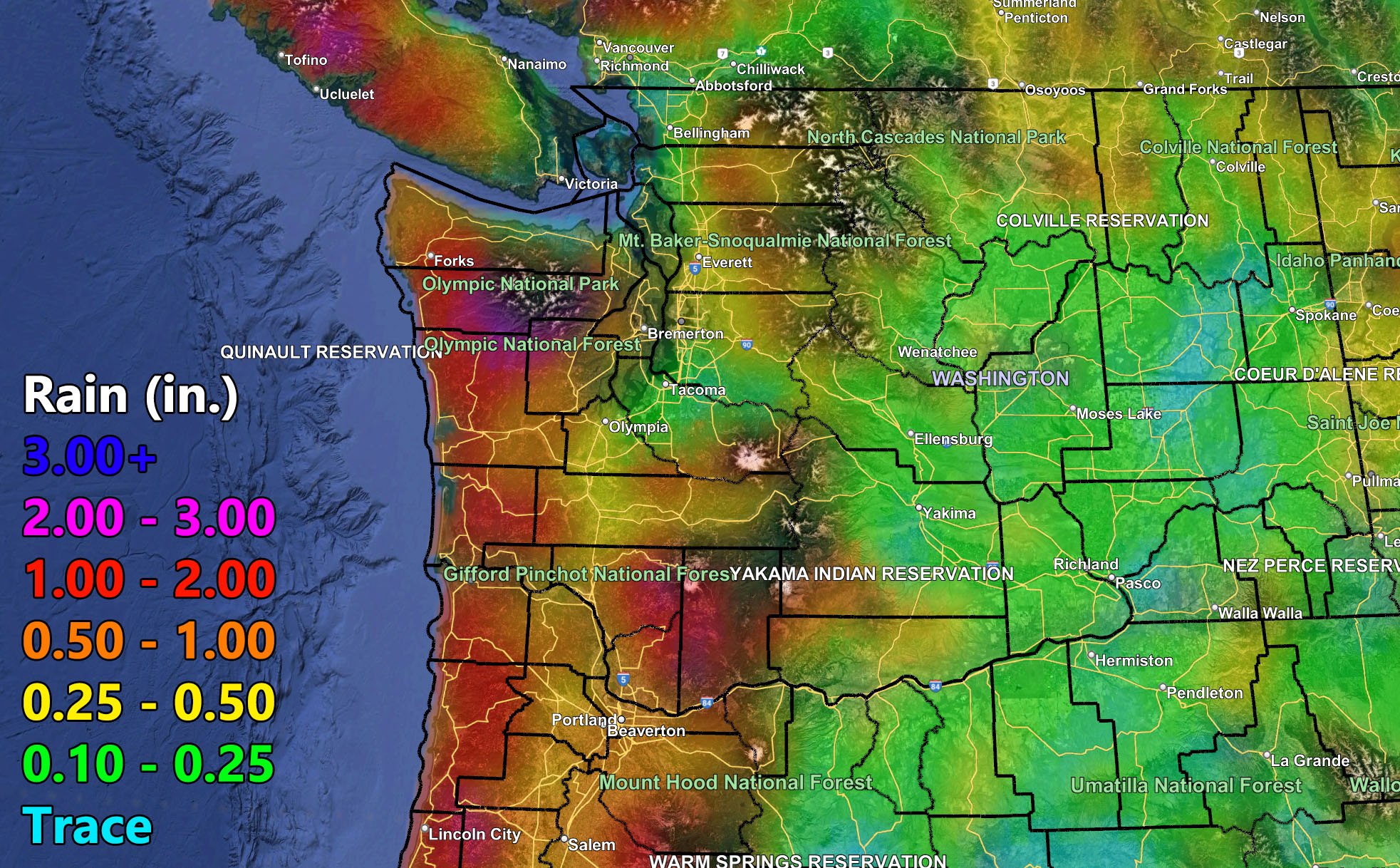
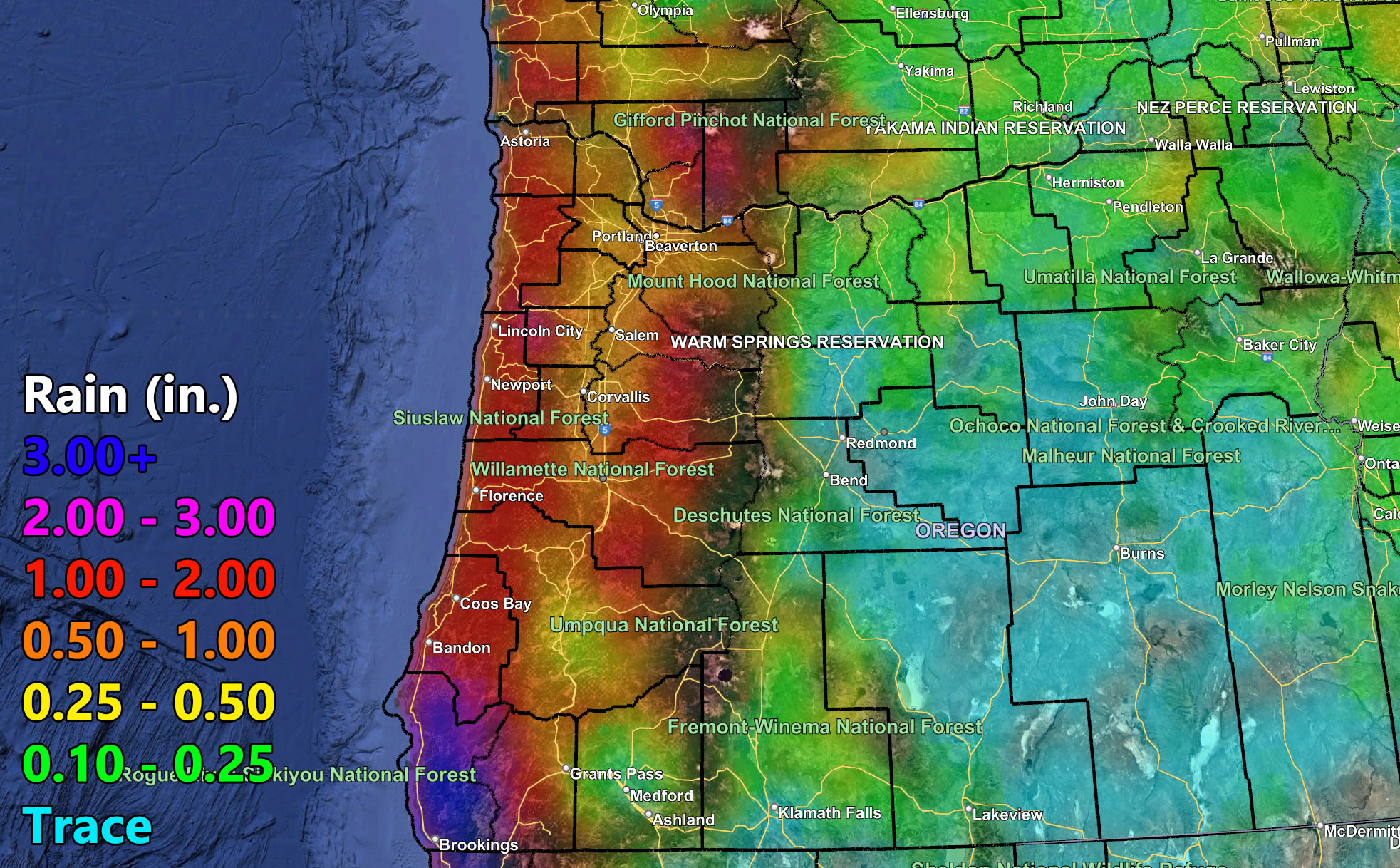
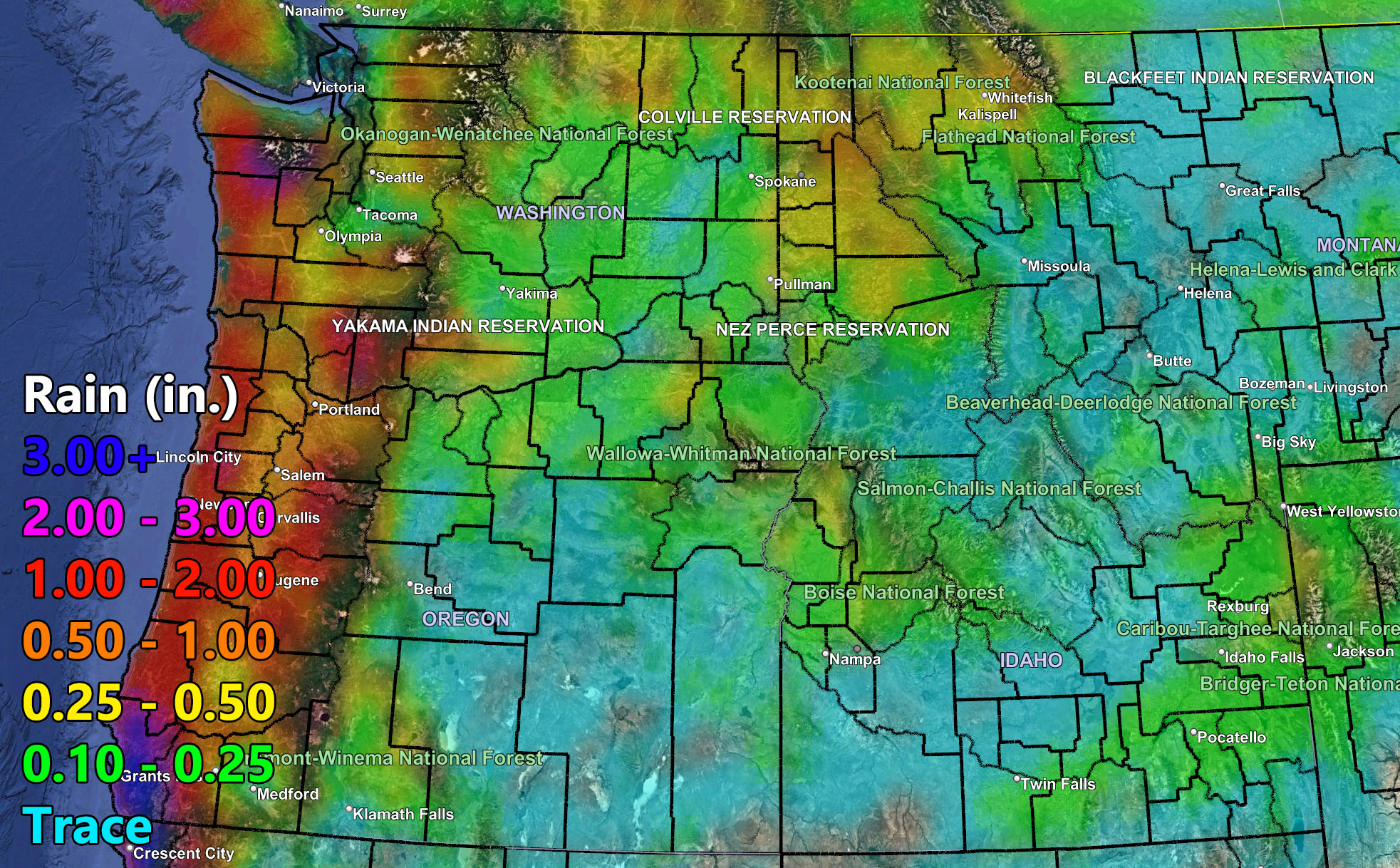
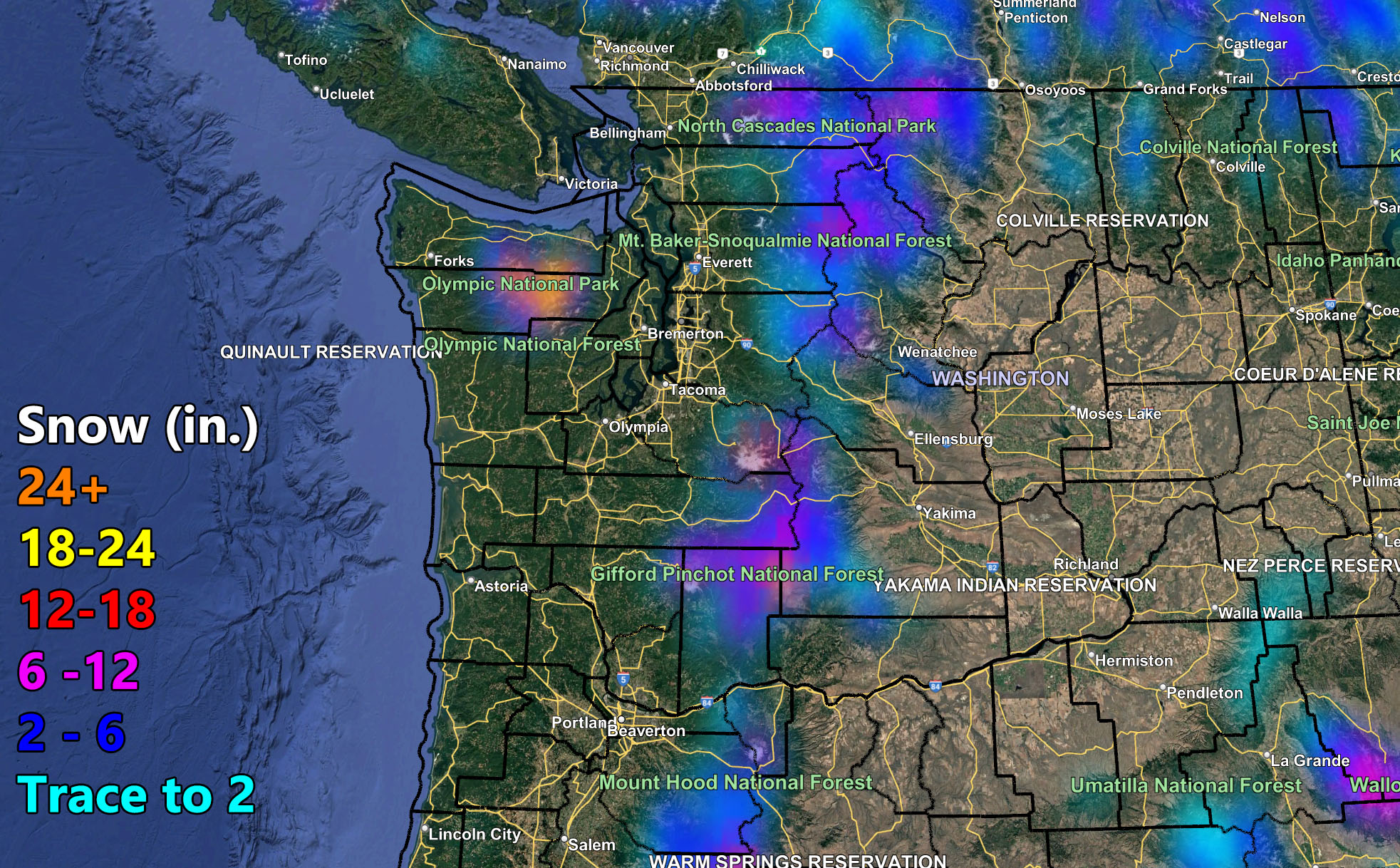
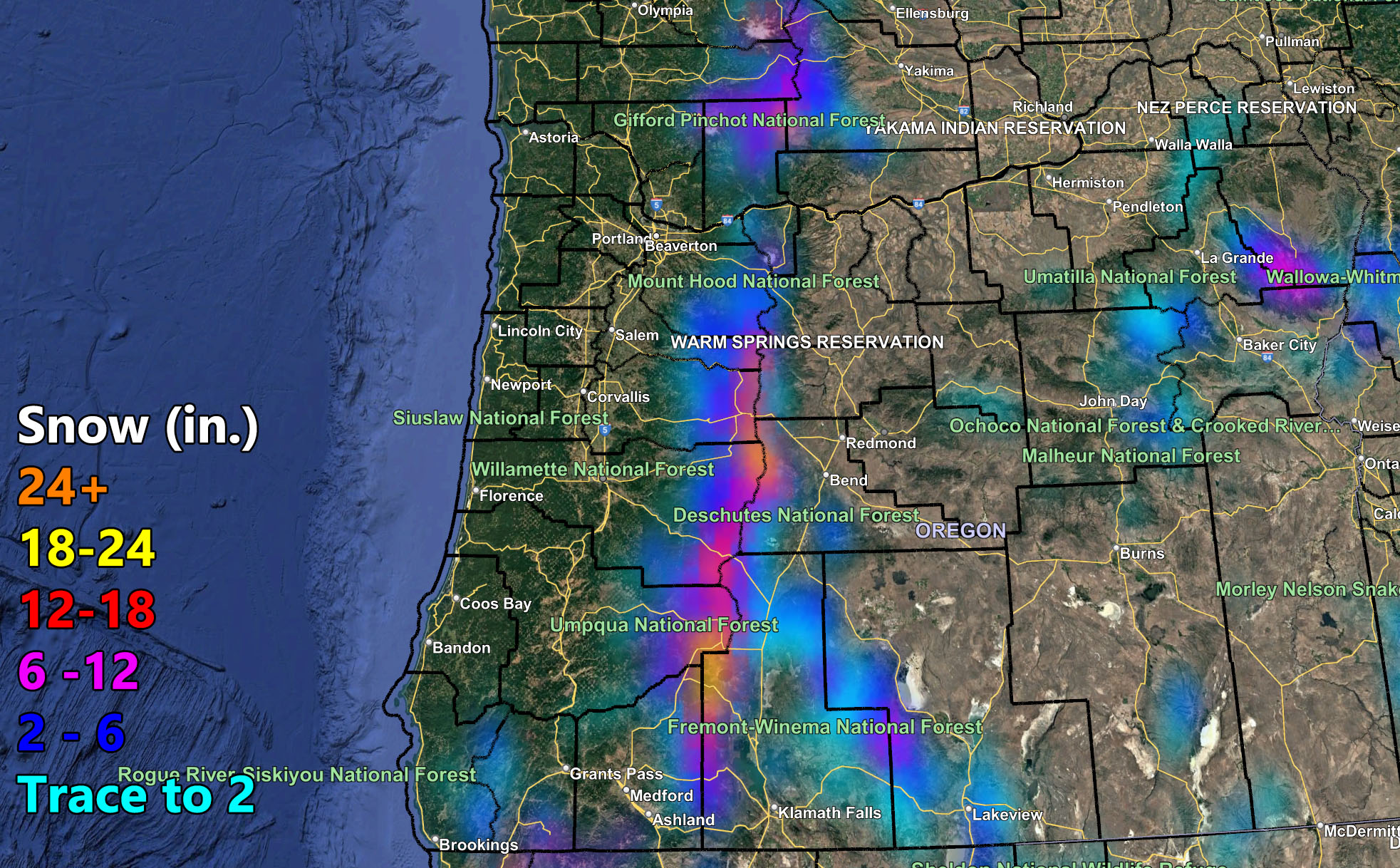
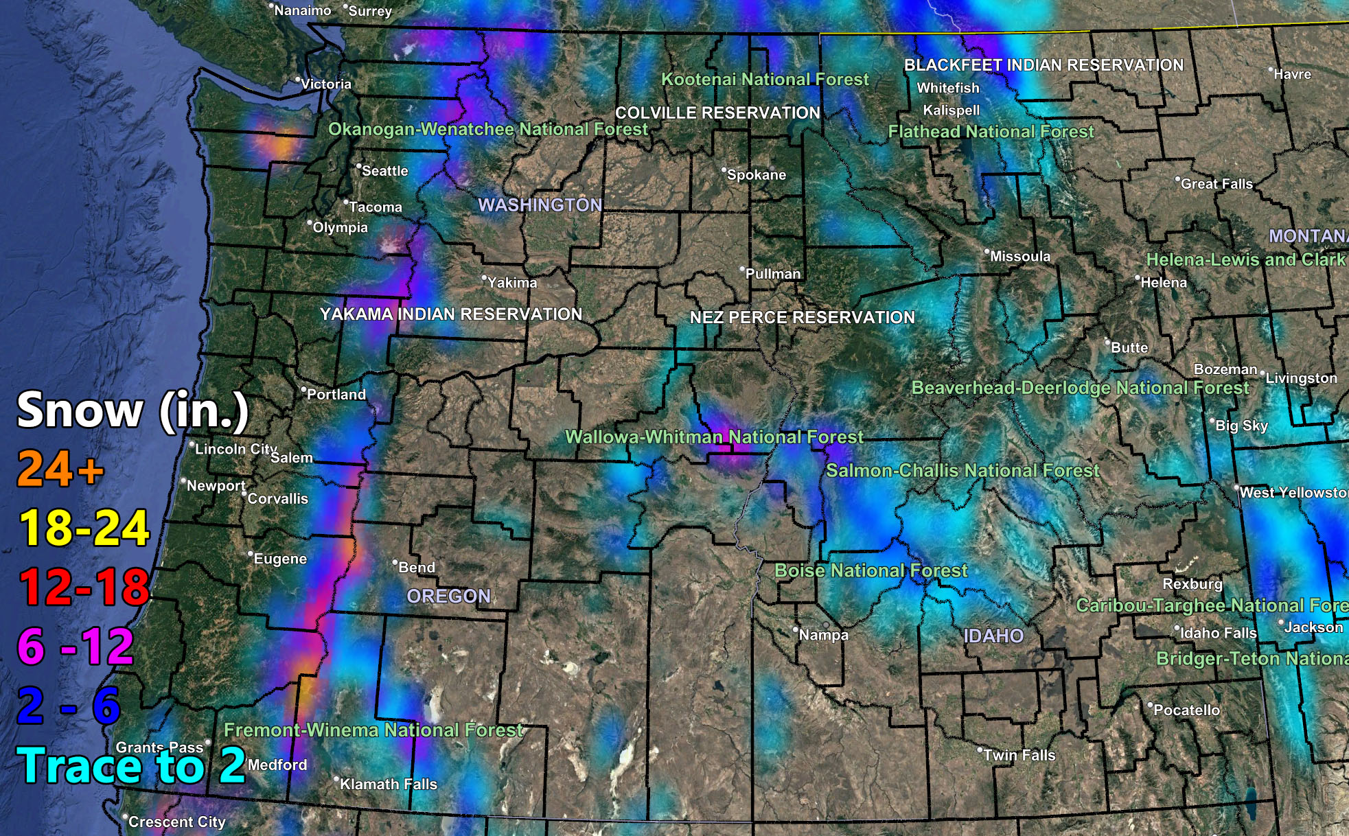
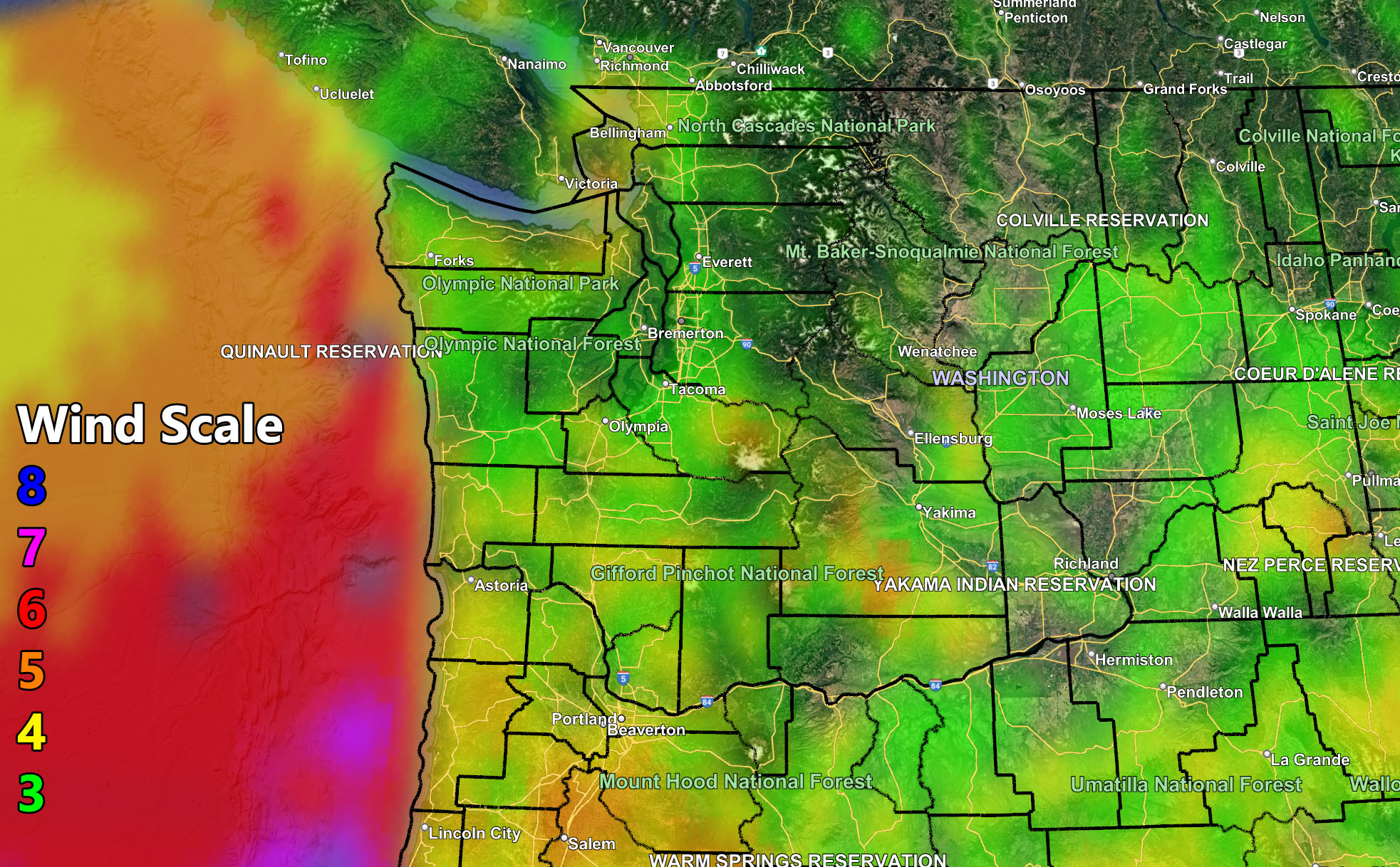
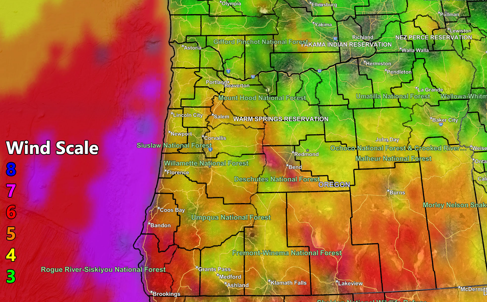
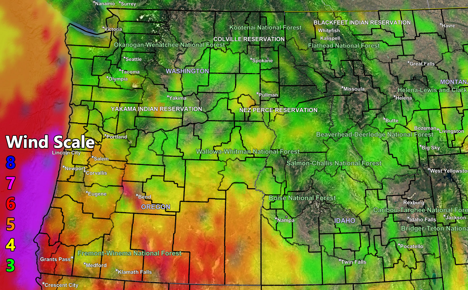
Use the rain, snow, and wind maps below for your 24 hour forecast that goes from today through Friday …
RAIN
SNOW
WIND
Raiden Storm Wind Gust Intensity Scale –
8. Extensive widespread damage.
7. Trees are broken or uprooted, building damage is considerable. – High Profile Vehicle Roll-Over CERTAIN.
6. SOME Trees are broken or uprooted, building damage is possible. – High Profile Vehicle Roll-Over Likely, Do NOT recommend Traveling in this zone. This zone also is the starting zone where trees and powerlines will fall and damage cars and even kill people near or in them!
5. Slight damage occurs to buildings; shingles are blown off of roofs. HIGH WIND WARNING CRITERIA – High Profile Vehicle Roll-Over Possible if weight is not corrected.
4. Twigs and small branches are broken from trees, walking is difficult.
3. Large trees sway, becoming difficult to walk. WIND ADVISORY CRITERIA
Raiden Storm
Master General Meteorologist